The What
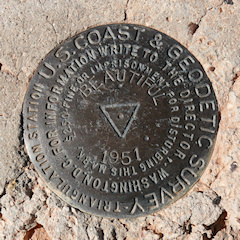
Survey marks or monuments are objects used to mark a precise location and/or elevation on the earth. The markers most survey mark hunters look for most often are 4-inch brass or aluminum disks installed into a stable setting like bedrock, an embedded boulder, a specially-poured concrete monument, a large building or bridge. Earlier survey monuments were made of stone or even buried bottles or jugs.
Some other types of survey marks are also included in the database, such as landmark stations—tall structures that can be sighted on from a distance so that trigonometric calculations can be made. Airway beacons are of this type.
Survey mark hunting, sometimes referred to as “benchmark hunting” regardless of the type of marker being sought, is simply the activity of searching for these survey marks. When we find, or “recover,” a mark, we do not take it or disturb it in any way. We document the mark’s condition and make note of any updates to the description and geographic coordinates that we think are needed. Then, when applicable, we send our report to the National Geodetic Survey (NGS) or the U. S. Geological Survey (USGS).
The Why
These markers are simultaneously a link to the past and part of a stable network from which much of our modern progress emerges. They are tangible evidence of the importance of knowing your position and being able to describe it accurately and were the culmination of centuries of work toward that end. They were also a step toward the now-ubiquitous technology of GPS, a technology that ultimately brought the accurate knowledge of place into the hands of people worldwide and made it a part of our everyday lives.
Sorting through layers of history as I try to find these markers brings me a knowledge of my local area and other areas I visit—a knowledge more intimate and exciting than can be gleaned from history books or visits to tourist sites. We learn where the old one-room schoolhouses were, learn about how air navigation worked decades before GPS (and even prior to radio communications!), find stones from the foundations of long-gone homes, and trace the still remaining paths of railroads that built this country and are now overgrown.
It’s also an inspiration to me to think of the early surveyors setting out across truly untouched wilderness or pioneer aviators flying off into the night, having to submit to being unsure at any given time exactly where they were or how conditions would be upon their arrival or attempted landing. It puts my own fears into major perspective.
The How
My “Beginners’ Guide to Survey Mark Hunting” is still a work in progress.
The Disclaimer
I am not a surveyor, nor have I ever been one. I haven’t even played one on TV. (Although I’m sure I would be a better surveyor than I would an actor.)
This site is intended to be a catalog of my own adventures in finding survey markers and a resource for others who wish to have survey mark hunting adventures of their own. It is meant to share the excitement of the hunt as well as the maps, documents, and other knowledge sources that I use to zero in on the locations of these marks.
It’s very satisfying to hear that surveyors find my work on these pages helpful—many have reported that they use the collection of local control monument databases—and I report my finds (and most unsuccessful attempts) to NGS and USGS so that they may update their official databases. But because I haven’t actually worked in the field, I can’t give an expert opinion about the condition of markers or their settings. And I can’t vouch for the legality of access to any survey mark, as conditions and property boundaries can change at any time. I am, however, sincere in my efforts and try my best to convey an accurate sense of the marker’s condition as well as a description of its surroundings, ease of access, and possible future threats to the stability or accessibility of the mark.