- Coordinates:
- N 41.51420° W 75.71686°
- Location:
- Elevation:
- Unknown
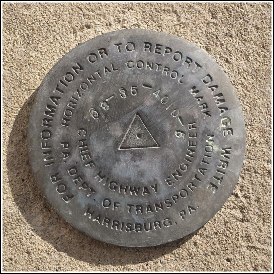
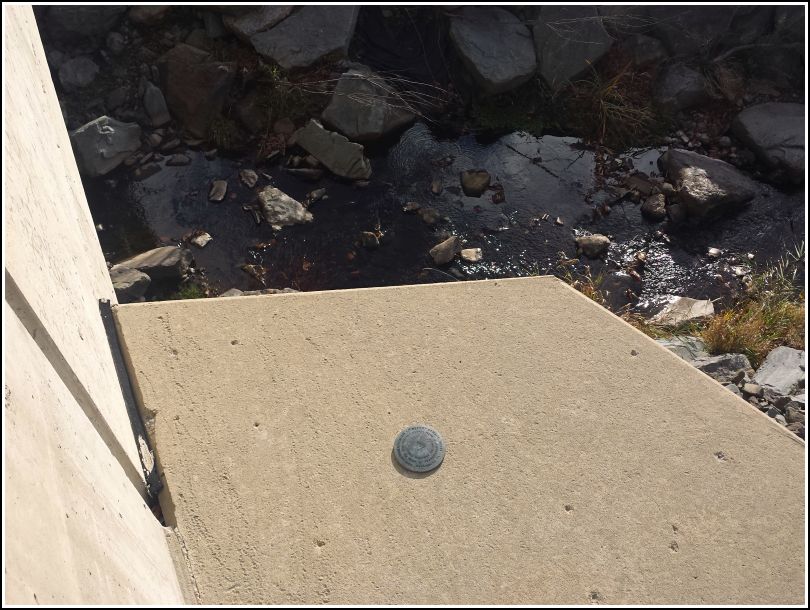
- Type:
- Horizontal Control Disk
- Setting:
- Bridge Wingwall
- Year Established:
- 2008?
- Established By:
- PennDOT
- Status:
- Recovered
- Condition:
- Good as of November 15, 2014
Rich, Dad and I spent this cold Saturday morning following the path of the Northern Electric trolley, an early 20th century interurban electric railway that ran from Scranton through the Abingtons and eventually to Montrose. The Countryside Conservancy has acquired several miles of the former right-of-way from North Clarks Summit to Dalton and has created a modern trail with a crushed granite surface. We parked near the trailhead at the intersection of Route 11 and Old State Road and followed the Trolley Trail northwest.
As we neared Ackerly Park, we were confused by the "Little League trail" signs with arrows pointing to the left; we thought that trail simply led to the Little League park at Ackerly Fairgrounds, so we continued out onto Ackerly Road and rejoined the trail on the opposite side of the park. (We learned upon our return that we should have followed the signs through the park, in fact following the route of the Northern Electric as it crossed the creek and park via a trestle.) Our Ackerly Road detour had one benefit, though: finding this PennDOT mark. It's a horizontal control mark, which is somewhat less common, and it's in very good condition.