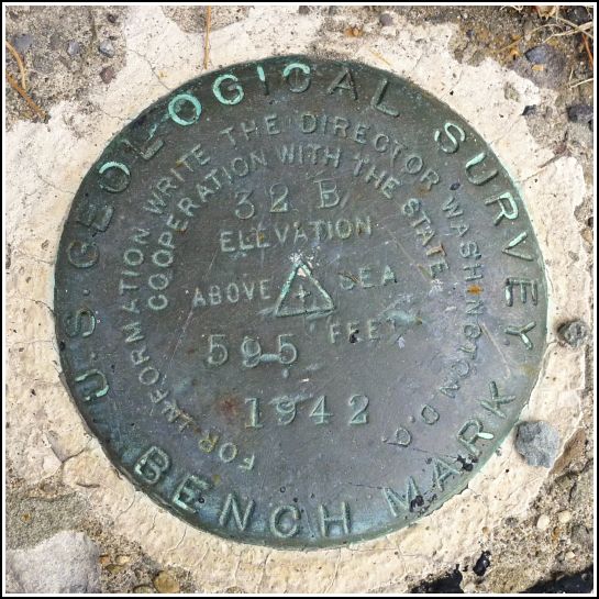
- Coordinates:
- N 41.44138° W 75.86024°
- Location:
- Elevation:
- 595.530 ft.

- Type:
- Bench Mark Disk
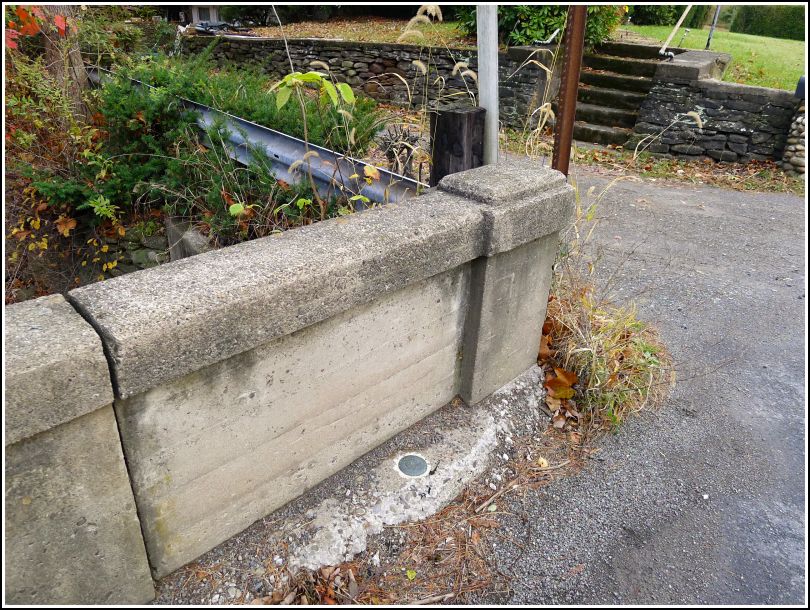
- Setting:
- Bridge Parapet Wall
- Year Established:
- 1942
- Established By:
- USGS
- Status:
- Recovered
- Condition:
- Good as of October 30, 2014
-
Official USGS Description:
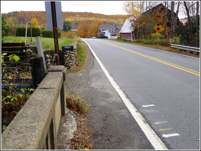
Falls, 1.8 mi SW. of, along State Highway 92; 0.14 mi SW. of intersection of State Highways 92 and 292; 15 ft N. of center of hwy.; in . end of N. parapet wall of new concrete bridge; standard tablet stamped "32 B 1942 595"
Almost three weeks ago, following a tip from Dad, I took the back route to Dallas through Newton-Ransom, Falls, and Center Moreland. I was so impressed by the beauty of this area (admittedly enhanced that day by wisps of early-morning fog and brilliant peak autumn colors) that I immediately decided to come back with Rich to share it with him—and look for a few benchmarks along the way, if there were any to be found.
When I passed over this bridge that day, it occurred to me that this was a likely spot for a benchmark—if nothing else, perhaps an old PDH mark. I checked out the topo map when I returned home, and it indicated an even better "treasure": a USGS benchmark supposedly set on the bridge! We worked it into today's route, which took us counterclockwise through Falls, Vernon, Center Moreland, Orange, and eventually down into Swoyersville (site of the Tipsy Turtle 2!).
We were both expecting to find the disk on top of the wall of the bridge, and we were a little surprised when we saw nothing but concrete. A few seconds later, though, Rich looked down and said "Oh, here it is." The mark is set into the parapet wall, but it's nearly level with the road. The disk itself is in good condition, but the concrete into which it's set is eroding. For now, though, I don't think the disk is in danger of movement or damage.