- Coordinates:
- N 41.65587° W 76.26449°
- Location:
- Elevation:
- Unknown
- Type:
- Elevation Mark
- Setting:
- Bridge Wingwall
- Year Established:
- 1968
- Established By:
- USGS
- Status:
- Recovered
- Condition:
- Good as of July 17, 2015
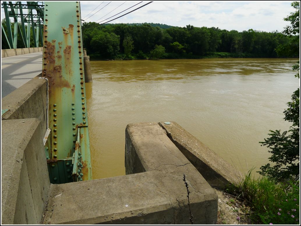
We haven't yet ordered the USGS datasheets for this quad, so we don't have a description for this mark and had no idea what we would find at the coordinates. It was a pretty good guess that the mark would be on the wingwall of Wyalusing's Rainbow Bridge. Aerial imagery indicates that the bridge is still a 4-span Parker through truss bridge, just as constructed in 1942, so it was a distinct possibility that the mark was still in place and undisturbed.
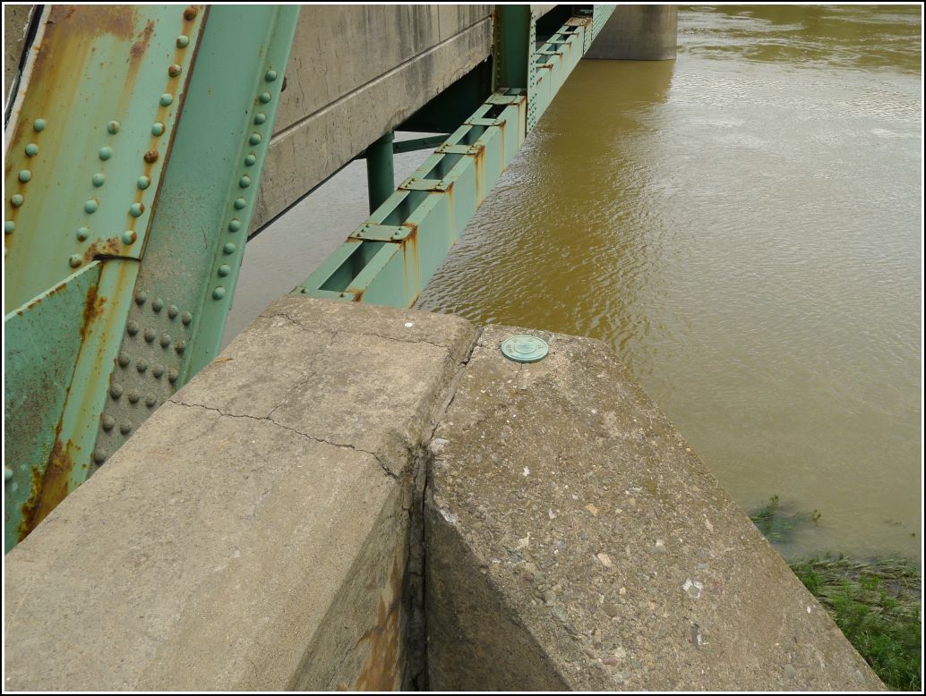
When we arrived at the coordinates, Rich pointed out that he saw not just one disk, but two set at the southeastern end of the bridge. The first one we spotted is a new (2013) PennDOT disk set on the wall of the bridge, while the mark indicated on the topo map is set into the bridge wall above the wingwall.
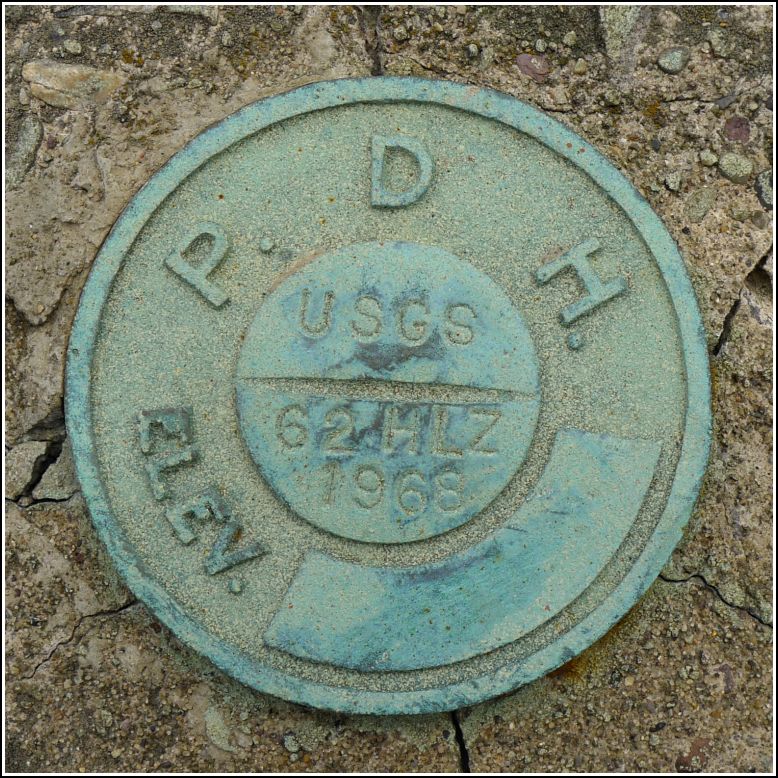
This bench mark is actually an old PDH disk, probably set anywhere between 1942, when the bridge was constructed, and 1968, when it was surveyed by USGS and stamped "USGS 62 HLZ 1968". This is one of a few examples of old PDH/PDT marks being later repurposed and stamped by USGS. We also recognized HLZ as Harry L. Zehner, surveyor of two USGS marks we found last year near Cortez (1 HLZ and 3 HLZ). The disk is in very good condition and enjoys a scenic spot overlooking the river (or it would, if it had eyes).