- Coordinates:
- N 41.63760° W 75.59953°
- Location:
- Elevation:
- Unknown
- Type:
- Unspecified Disk
- Setting:
- Bridge Wingwall
- Year Established:
- 1996
- Established By:
- PA Dept. of Highways
- Status:
- Recovered
- Condition:
- Good as of June 20, 2015
-
Official PA Dept. of Highways Description:
Unavailable.
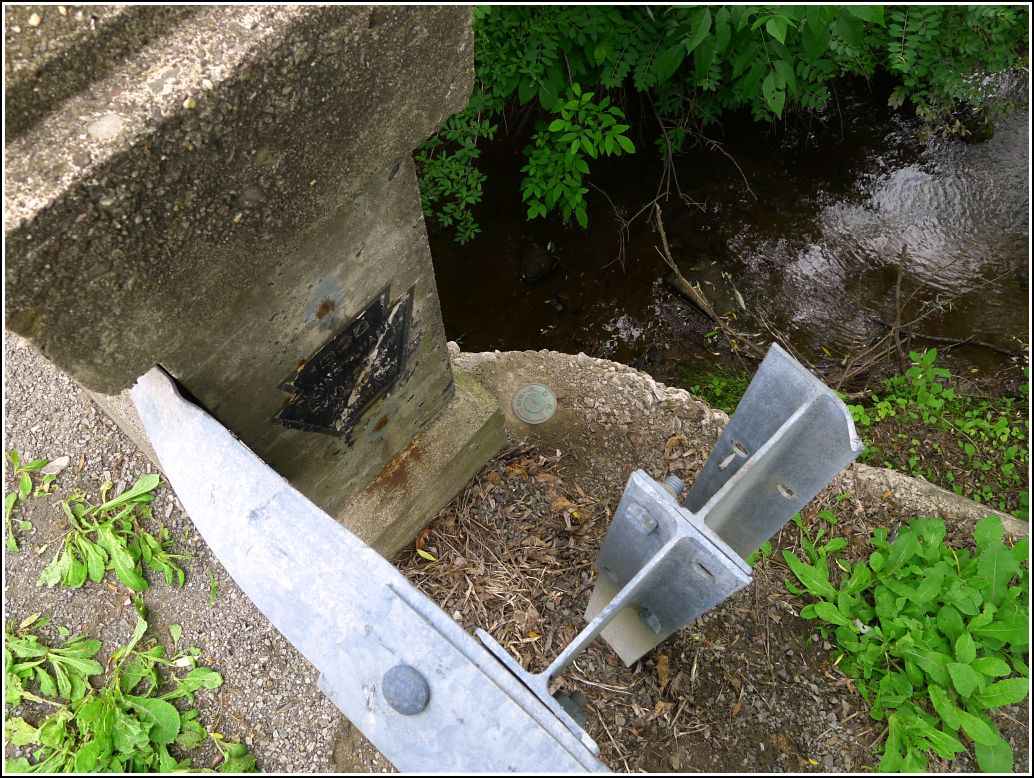
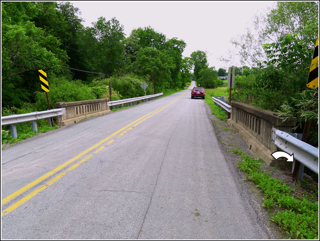
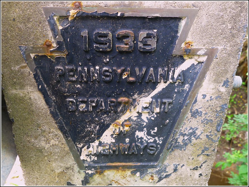
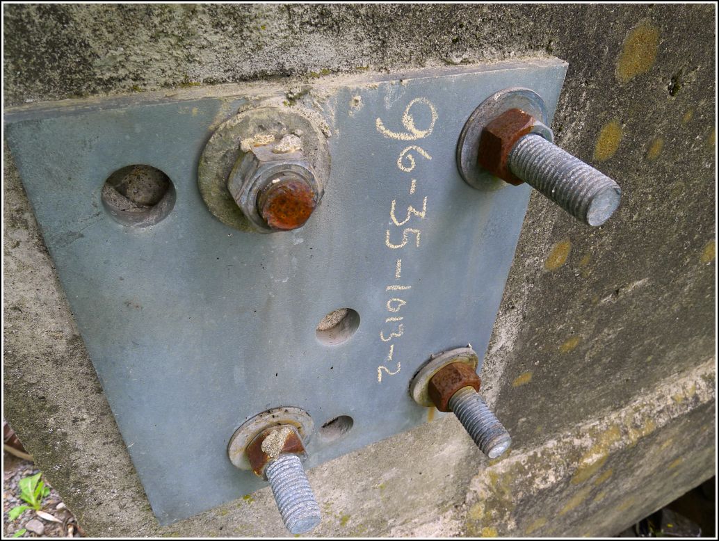
We returned to the Waymart area today to complete our loop of eight marks that we had prepared for last weekend. The first mark on our list was in Pleasant Mount, and our GPS routed us north through Clifford rather than through Waymart as we had expected. Along the way, I noticed this old concrete bridge with a PDH plaque. Rich pulled over, and Dad and I checked the wingwalls for benchmark disks. We didn't see anything obvious at first, but then I noticed the designation 96-35-1013-2 written on a metal plate fastened just above the southeastern wingwall. The wingwall was encrusted with mud and gravel, but we scraped it off and found a nice PDH survey disk hiding underneath. It's an old disk, but was stamped (we assume in 1996) with the modern PennDOT designation.