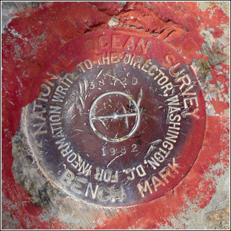
- NGS PID:
- AA0828
- Coordinates:
- N 24.839654° W 80.779985°
- Location:
- Elevation:
- 16.60 ft.

- Type:
- Tidal Bench Mark Disk
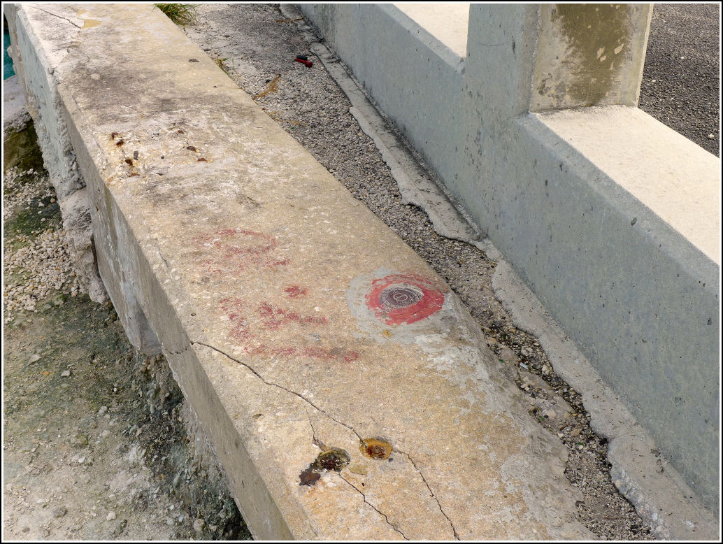
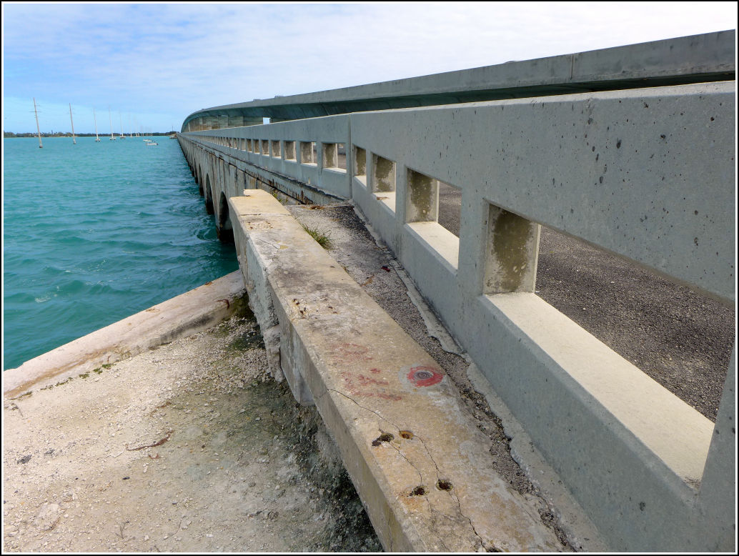
- Setting:
- Concrete Bridge Sidewall
- Year Established:
- 1982
- Established By:
- Florida Dept. of Natural Resources
- Status:
- Recovered
- Condition:
- Good as of February 22, 2016
- Official Description: NGS Datasheet
While on our Long Key benchmark bonanza, Rich and I made a fortuitous stop at the fishing pier at the western end of the bridge over Channel 5, northeast of Long Key. Among several disks we found at this location was 872 3872 D TIDAL. It's set into the north curb of the old Route 1 bridge (now a fishing pier at this location) at the western end of the bridge. It is in good condition.
Updated GPS coordinates have been submitted to NGS.
A report on the condition of this survey mark has been submitted to NGS, along with the following recovery note:
Recovered in good condition. The mark is located on the north curb at the western end of the old bridge over Channel Five, which is now a fishing pier. The current U.S. Route 1 bridge is directly south of the old bridge.