- NGS PID:
- KV1670
- Coordinates:
- N 40.665889° W 75.301036°
- Location:
- Elevation:
- 442.40 ft.

- Type:
- Triangulation Station Disk
- Setting:
- Square Concrete Monument
- Year Established:
- 1960
- Established By:
- NGS
- Status:
- Recovered
- Condition:
- Good as of April 26, 2015
- Official Description: NGS Datasheet
This year we weren't planning on searching for any survey stations on our way to the Banff Mountain Film Festival showing in Bethlehem. But last night I saw this one on a topo map and considered the possibility of searching for it if we had time. It was even more intriguing because the latest recovery notes on both Geocaching.com and the NGS datasheet reported the mark as "Not Found." We had to try!
The morning was spent hiking around Jacobsburg State Park with Dad. He had never seen the park, and Rich and I haven't been there in years because of the massive proliferation of poison ivy there in the early 2000s. We had some unfortunate encounters with it then, and despite the fabulous mountain biking trails, have avoided the park ever since. I'm happy to report that the trails—at least in the southern section of the park—have been largely purged of the evil stuff, as well as improved and widened in some spots.
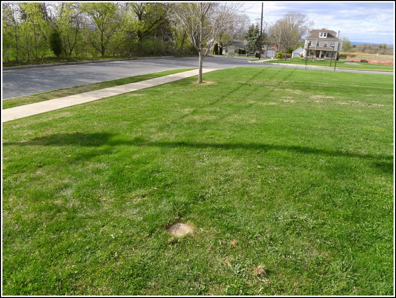
We had plenty of time after our lunch at McCarthy's in Bethlehem to take a drive by the coordinates for this tri-station. Initially I saw nothing, certainly no obvious monument protruding above the grass. After a few minutes spent poking around, though, Dad exclaimed "Here it is!" He had found the monument, with the station disk intact, half-buried in the lawn. He marked the location with a small branch shoved into the dirt while we went to search for the reference marks.
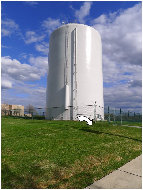
Here, we weren't so lucky. Rich paced out the distance (we didn't have our tape measure with us) and we used the handy nails in addition to our compass to determine the direction. It seems that the location of RM 1 is now beneath the pavement of the small driveway leading into the water tower facility. It's likely that the monument is gone. RM 2 may still exist but if it does, it is buried beneath the grass. It should be located near the small tree adjacent to the sidewalk that's visible in the photo. A metal detector might help, but I wouldn't dig here without permission.
I noticed while taking my photos that there is a piece of relatively new pink flagging tape tied to the corner of the water tower fence nearest the station mark. Perhaps this is evidence that the mark has been used by local surveyors, or at least that they're aware of its existence?
We didn't attempt the azimuth mark because several earlier NGS recoveries confirm that it has been destroyed.
The station mark was recovered in good condition on the property of the Farmersville Elementary School, as described. The monument is flush with the ground. RM No. 1 and RM No. 2 were searched for but not found. It is likely that they were obscured or destroyed by the construction of the sidewalk and driveway leading into the adjacent water tower. The azimuth mark was not searched for because earlier recovery notes confirmed its destruction.


| Designation | Status | Condition | Image |
|---|---|---|---|
| FARMERSVILLE RM 1 | Not Found | Unknown (Not Found) |  |
| FARMERSVILLE RM 2 | Not Found | Unknown (Not Found) | |