- NGS PID:
- KW1173
- Coordinates:
- N 40.421277° W 76.576833°
- Location:
- Elevation:
- 464.90 ft.

- Type:
- Bench Mark Disk
- Setting:
- Concrete Culvert
- Year Established:
- 1960
- Established By:
- NGS
- Status:
- Recovered
- Condition:
- Good as of February 13, 2015
- Official Description: NGS Datasheet
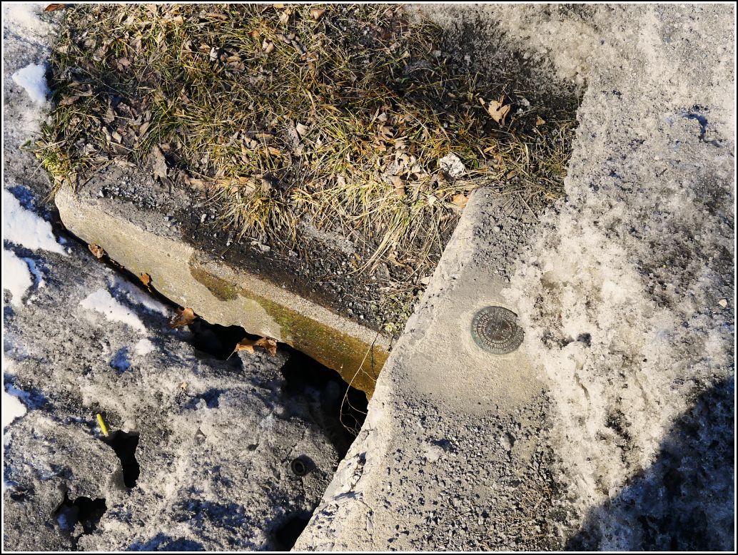
At first, this mark seemed like a long shot. This long, frozen-solid, snowy winter has produced several-foot-high icebergs along every road in northern Pennsylvania. I was hoping that the further south we went we'd see less snow, but Harrisburg obviously wasn't nearly far enough south.
As we turned onto Indiantown Gap Road and I looked over toward where I expected to find the culvert, I really wasn't surprised to see yet another wall of dirty ice studded with gravel. The culvert's location was marked with the typical red posts. While Rich stayed toasty warm in the car, probably thinking we were crazy (and we are), Dad and I went out in windy 2-degree weather to check out the culvert. To our complete shock, the disk was miraculously exposed in a gap beneath an overhang of frozen filth!
The disk is scratched but stable with a legible designation. It is set in the top of a concrete culvert in the south corner of Fisher Ave (Rt. 934) and Indiantown Gap Road.
Mark recovered in good condition on the concrete headwall of a culvert, as described. The culvert is in the south corner of the intersection of Fisher Avenue (N. Route 934) and Indiantown Gap Road. It is southwest of Funck's Restaurant and Exxon station. Handheld GPS coordinates for the bench mark are 40 25 16.59(N) 076 34 36.60(W).