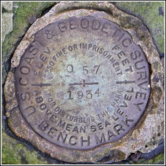
- NGS PID:
- LY1362
- Coordinates:
- N 41.46032° W 75.85028°
- Location:
- Elevation:
- 585.07 ft.

- Type:
- Bench Mark Disk
- Setting:
- Bridge Spandrel
- Year Established:
- 1934
- Established By:
- NGS
- Status:
- Recovered
- Condition:
- Good as of October 30, 2014
- Official Description: NGS Datasheet
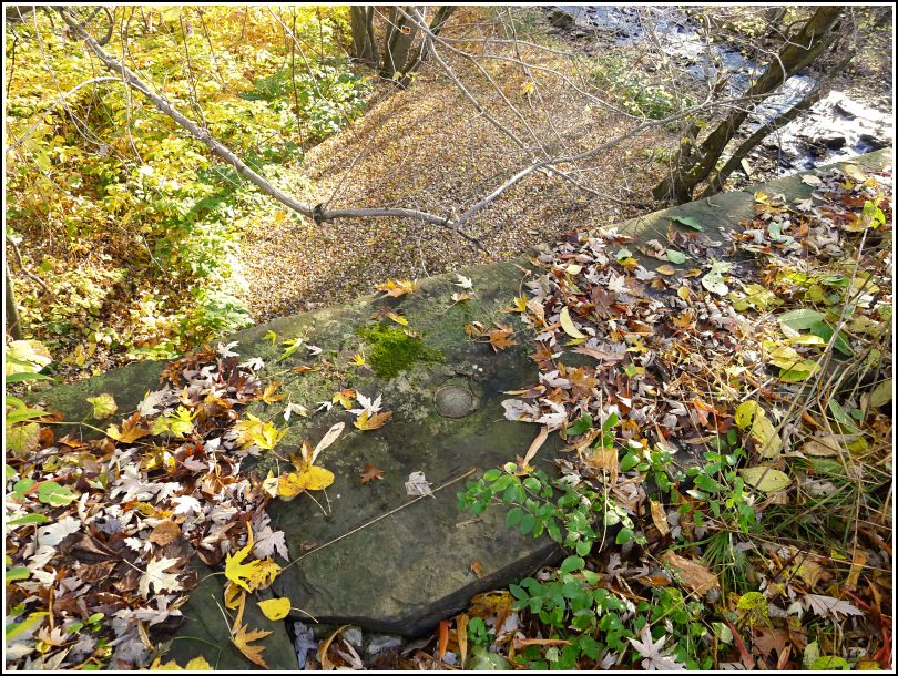
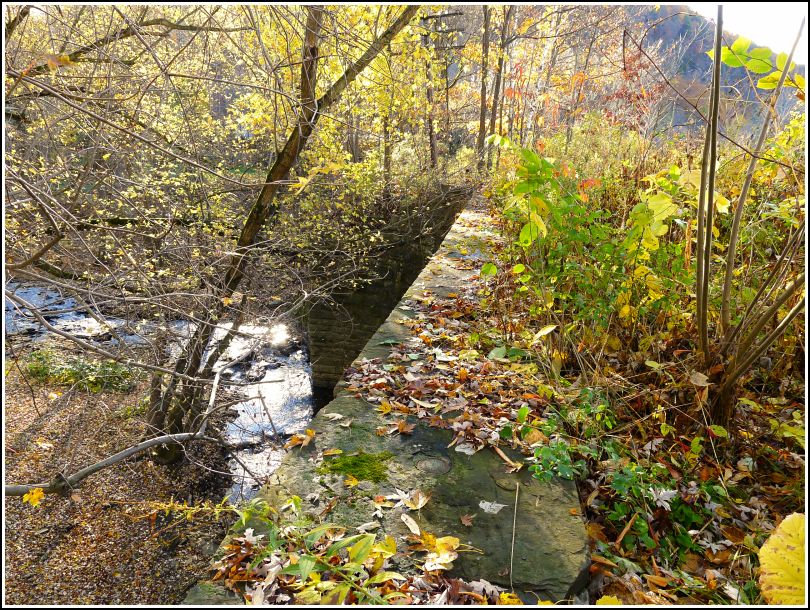
I recall being surprised a few weeks ago when I realized there were no NGS survey marks on the Falls bridge, a prominent landmark in these parts (mainly because it's the only place to cross the river between Pittston and Tunkhannock—but it's still a neat bridge). There is, however, an NGS benchmark, Q 57, just about 1000 ft. to the southeast along the railroad. The disk is set into a stone arch bridge over Buttermilk Creek, the source of the falls that gave the town its name.
Rich and I parked along the road just south of the bridge and took a short and easy walk down the tracks to the railroad bridge. We found the mark quite easily in the top center of the eastern spandrel of the bridge, just as described. It is in good condition. Weak sunshine illuminated the fallen leaves, and from our high perch we could see the brilliant carpet of orange stretching east to the falls, which were just barely visible through the trees. It was the beginning of a gorgeous fall day!
Recovered in good condition. The bench mark is set in the top of the east spandrel of a railroad bridge over Buttermilk Creek. Handheld GPS coordinates for the mark are 41 27 37.20(N) 075 51 01.01(W).