- NGS PID:
- LY2803
- Coordinates:
- N 41.53485° W 75.899533°
- Location:
- Elevation:
- 1882 ft.

- Type:
- Traverse Station Disk
- Setting:
- Bedrock
- Year Established:
- 1968
- Established By:
- NGS
- Status:
- Recovered
- Condition:
- Good as of October 2, 2003
- Official Description: NGS Datasheet
This early Fall day was perfect for a lengthy hike with a benchmark recovery as our goal. Our approach took us from Routes 6 & 92 in Tunkhannock to Lane Hill Road, from which we continued onto Hobbs Road. We parked at the end of the pavement, where a cable crosses the road, and hiked the remaining one and one-eighth mile on steep, well-defined trails to the summit of Osterhout Mountain. Once at the top we spotted a woods road joining our trail from another direction, which may provide easier access to the summit. We didn't investigate it at the time and cannot find any indication of this road on topo maps or aerial photographs.
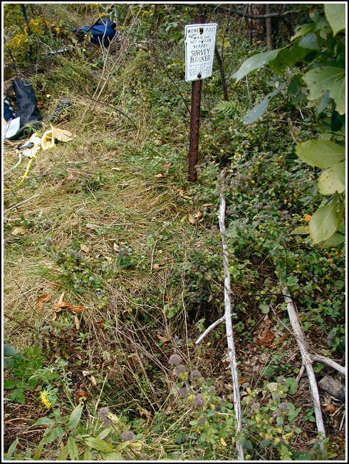
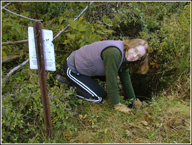
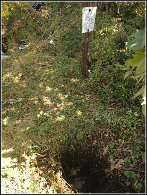
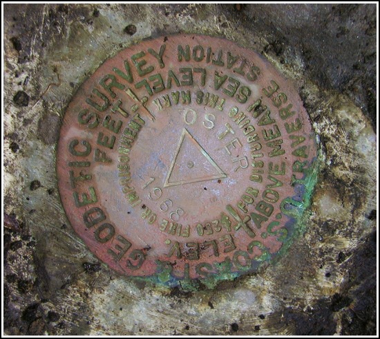
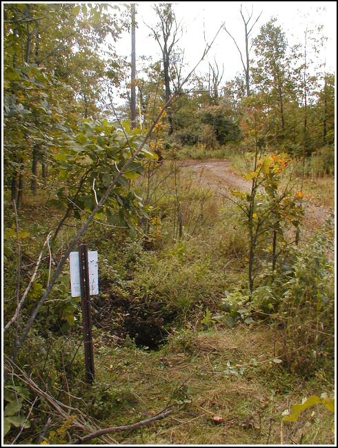
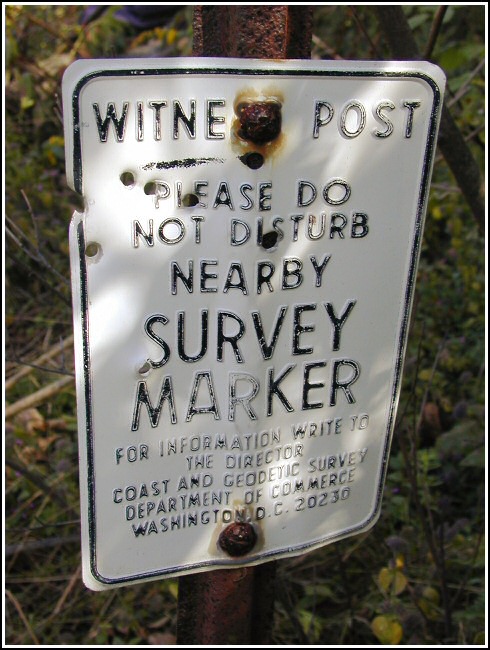
Our initial fears about the station mark being underground were quelled when we saw the depression in the ground near the witness post. It seemed someone had done half our work for us. The station was used at some point after its monumentation and then covered loosely by soil and rock. Digging down another twelve inches was nevertheless required to view the disk. The witness post and sign are still in place and helped further confirm we were excavating the correct spot. It took a bit of work, but the disk was eventually revealed. It is in excellent condition. Before leaving the area, we covered the station to protect the disk and refilled the hole with soil to the level at which we found it.
Both reference marks were found in good condition as described. RM2 is set on a boulder overlooking the valley and was exposed and therefore easy to spot, while RM1 required some digging to locate beneath a layer of soil and leaves. Distances and directions to the station match those given on the datasheet.
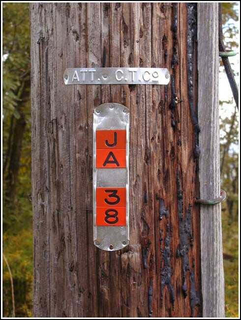
As we reported for LY2800, the antenna pole has been destroyed. The airway beacon tower, LY2802, has also been destroyed and the northwest leg, which is referred to in the station description, is entirely missing. In order to update the description, we took a measurement north-northeast to the station from what remains of the east leg of the tower. We found this distance to be 19 feet. While at the summit of Osterhout Mountain, we noticed heavy clouds blowing in, and it began to snow.
After hiking back to the car we followed the historic description to the azimuth mark. The mark was found easily as described, except that the azimuth mark witness post was not located. The disk is in good condition. We took measurements from a nearby powerpole and highway sign to add to our report.
The station mark, reference marks 1 and 2 and the azimuth mark were recovered in good condition. The Pennsylvania Electric Company antenna pole has been destroyed. The northwest leg of the beacon tower no longer exists. The station mark is approximately 19 feet north-northeast of the remnants of the east leg of the beacon tower and 64 feet north-northeast of ATT C.T. Co. pole JA38. The azimuth mark is approximately 75 feet southeast of ATT C.T. Co. pole 11T924/LG50 and 40 inches east-southeast of a highway signpost. The witness post at the azimuth mark no longer exists.

Recovered in good condition.
This second order triangulation station is situated at the summit of Osterhout Mountain, east of Tunkhannock. The approach used for this recovery begins at the end of the paved portion of Hobbs Road where it turns into a woods trail with a cable across it preventing further vehicle travel. There is room here to park (N41° 31.739' W075° 54.408'). A hike on the woods trail for roughly 1.12 miles leads to the summit area, and a handheld GPSr made locating the site a very simple task. It was noted that a well-defined jeep trail joins the woods trail at the summit which means it's possible that there's an easier and/or shorter way to reach the station, but it was not investigated further at this time.
Once at the summit the historical description leads reliably to the station and the two reference marks. The metal witness post with sign still protects the station mark. The remnants of the northwest leg of the airway beacon tower was not found. A new measurement was taken from what remains of the east leg of the tower, placing the station 19 feet north-northeast of this leg. Also, the station is 64 feet north-northeast of ATT C.T. Co. utility pole number JA38. The location of the station mark was further indicated by a depression in the ground from a previous excavation. It was necessary to dig roughly a foot deeper in order to uncover the top of the monument and the disk.
RM1 is set in a flat outcropping rock near ground level and was obscured by a thick layer of loam and roots. RM2 is set near the center of a large outcropping boulder and was well exposed. The azimuth mark was located using the historical description. It was found covered with dirt, rocks and debris, and set in the top center of an old concrete culvert backwall, 75 feet southeast of ATT C.T. Co. utility pole 11T924/LG50 and 40 inches east-southeast of a highway signpost. The witness post no longer exists.
At the station a Garmin GPSmap76 receiver with active remote antenna was used to record autonomous (non-corrected) coordinates which were 4.6 feet from the adjusted coordinates listed on the NGS datasheet. All marks are in very good condition and the stamped designations are clearly legible. Before leaving, the station mark was covered with a piece of scrap plastic and two flat rocks, and then the hole was filled in to the level at which it was found. ~Rich in NEPA~


| Designation | Status | Condition | Image |
|---|---|---|---|
| OSTER AZ MK | Recovered | Good |  |
| OSTER RM 1 | Recovered | Good | 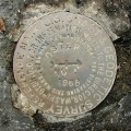 |
| OSTER RM 2 | Recovered | Good | 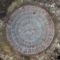 |