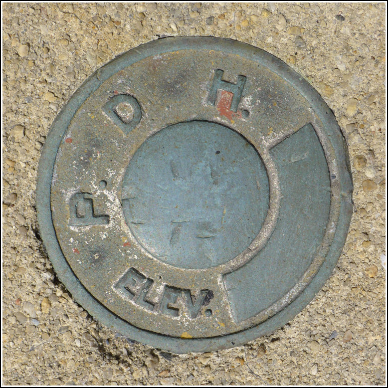
- Coordinates:
- N 40.787582° W 75.299111°
- Location:
- Elevation:
- Unknown
- Type:
- Unspecified Disk
- Setting:
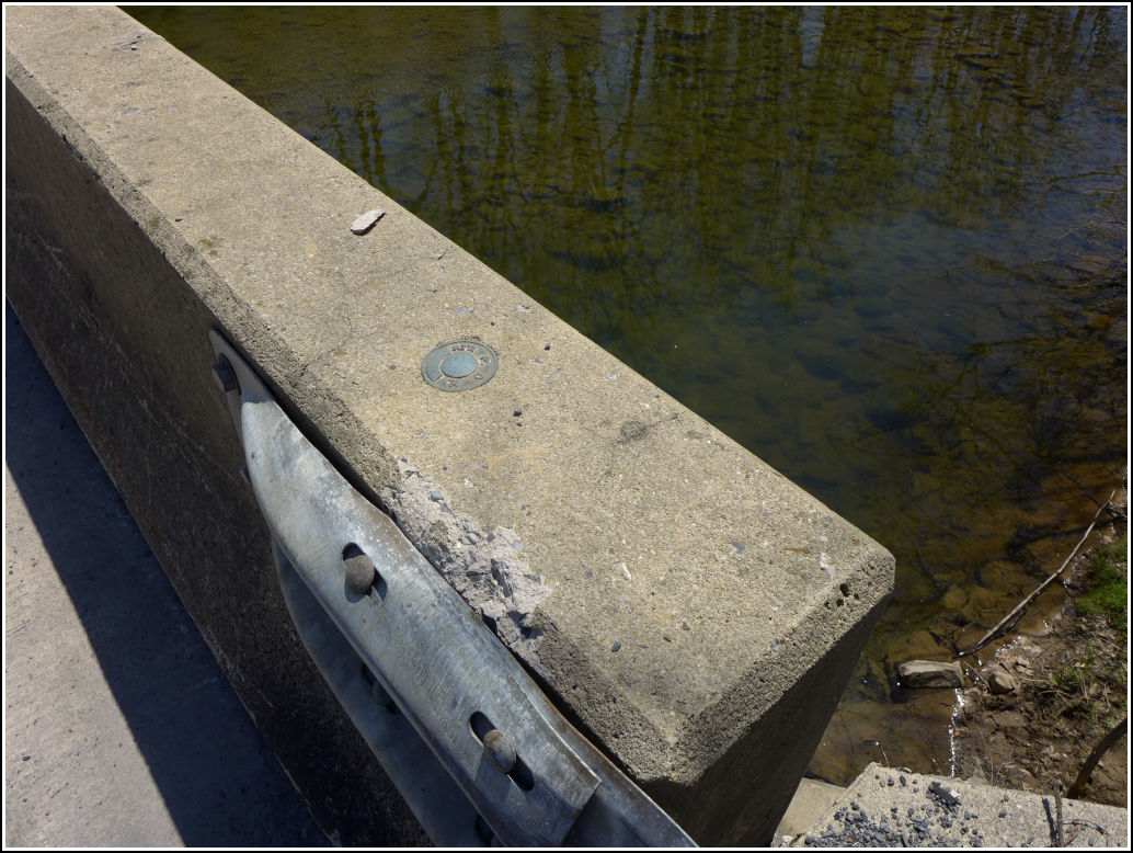
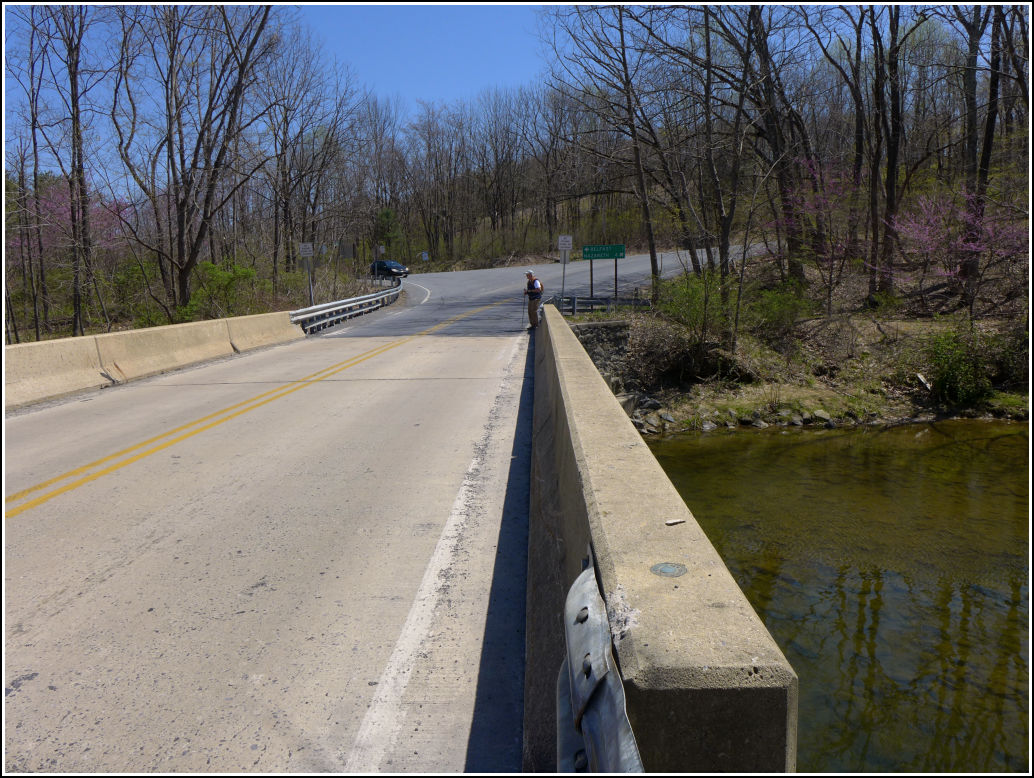
- Bridge Bannister
- Year Established:
- Unknown
- Established By:
- PA Dept. of Highways
- Status:
- Recovered
- Condition:
- Good as of April 24, 2016
This year, like last, we chose Jacobsburg State Park as our morning hiking destination before the Banff Mountain Film Festival showing in Bethlehem. Last year's hike took us to the southern section of the park, past the old Henry homestead and other sites of the historic town of Jacobsburg. This year we chose the western "Sorbers Run" section of the park. On our way there from the park's visitors center, Dad, Rich and I came across this old PDH disk. The disk is unstamped and undated and is in good condition. It is set into the northwest corner of the sidewall of a bridge carrying Jacobsburg Road over Bushkill Creek.