- Coordinates:
- N 41.44485° W 75.96007°
- Location:
- Elevation:
- Unknown
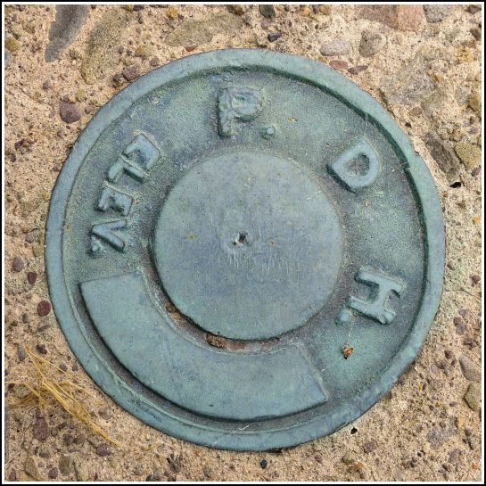
- Type:
- Elevation Mark
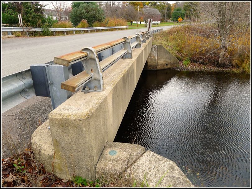
- Setting:
- Bridge Wingwall
- Year Established:
- Unknown
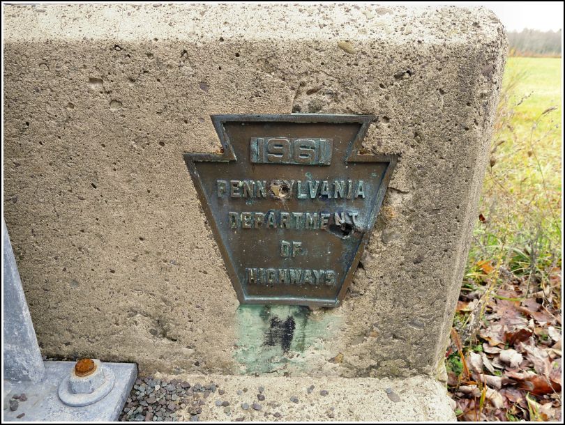
- Established By:
- PA Dept. of Highways
- Status:
- Recovered
- Condition:
- Good as of October 30, 2014
-
Official PA Dept. of Highways Description:
Unavailable.
There isn't much to say about this mark. Like many other PennDOT and PDH marks, we found it simply by checking out, on a hunch, an old bridge we happened to be passing over. It is unstamped and in good condition. We found it on a bridge over Marsh Creek along Graveyard Hill Road (great name, especially appropriate for the day before Halloween). We were our way to 37 B (now that was quite a story!). On the side of the bridge facing the road is a PDH bridge plaque giving the date of construction as 1961.