- Coordinates:
- N 44.31471° W 68.25309°
- Location:
- Elevation:
- Unknown
- Type:
- Boundary Monument
- Setting:
- Pipe Cap
- Year Established:
- Unknown
- Established By:
- National Park Service
- Status:
- Recovered
- Condition:
- Good as of September 11, 2014
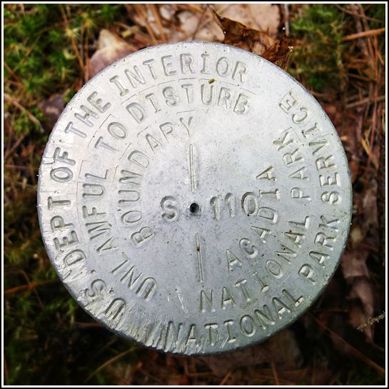
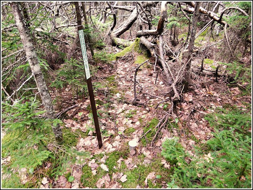
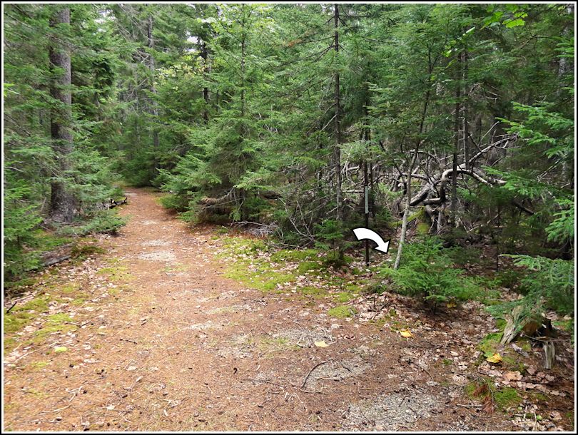
We were returning to Jordan Pond House along the carriage road after hiking about half of the Seaside Path. We had already found two boundary markers and enjoyed hiking what was, for us, a new trail. The afternoon's mist was turning to drizzle when I spotted an unmarked trail, possibly an old woods road, leading north from the carriage road. Near the intersection, we found yet another NPS boundary marker! This mark is stamped S 110 and its witness post is brown, similar to others we've found in the past but unlike the others we found today, which were orange. I suspect that they're used interchangeably, or maybe one style is newer than the other. Now we need to find S 111, S 112, and S 113!